Back Kunenerivier Afrikaans نهر كونين Arabic Kunene (kuksa) AVK Куненэ Byelorussian Кунэнэ (рака) BE-X-OLD Кунене (река) Bulgarian Riu Cunene Catalan Rio Cunene CEB Kunene (řeka) Czech Кунене (юханшыв) CV
| Kunene Cunene | ||
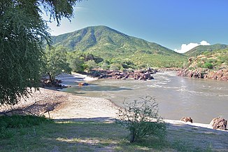
 Kunene nahe Epupa | ||
| Daten | ||
| Lage | ||
| Flusssystem | Kunene | |
| Quelle | Hochland von Bié, Lundaschwelle | |
| Quellhöhe | 1800 m | |
| Mündung | Südatlantik, Foz do Cunene (Kunenemund)Koordinaten: 17° 14′ 58″ S, 11° 45′ 12″ O 17° 14′ 58″ S, 11° 45′ 12″ O | |
| Mündungshöhe | 0 m | |
| Höhenunterschied | 1800 m | |
| Sohlgefälle | 1,7 ‰ | |
| Länge | 1050 km[1] | |
| Einzugsgebiet | 110.200 km²[1] | |
| Abfluss am Pegel Ruacana (64740001)[2][3] AEo: 89.600 km² Lage: 200 km oberhalb der Mündung |
MNQ 1961–1997 MQ 1961–1997 Mq 1961–1997 MHQ 1961–1997 |
38 m³/s 164 m³/s 1,8 l/(s km²) 480 m³/s |
| Linke Nebenflüsse | Osse (Chitanda), Otjindjangi | |
| Rechte Nebenflüsse | Catape, Que, Kalonga, Caculavar | |
| Durchflossene Stauseen | Talsperre Gove, Calueque-Damm | |
| Einwohner im Einzugsgebiet | 1.988.000[1] | |
 Karte des Kunene mit seinen Nebenflüssen, dem Oshana-System und der Etosha-Pfanne | ||
Der Kunene ist ein Fluss in Angola und Namibia im Südwesten Afrikas.
- ↑ a b c Source Book - Africa’s River Basin Organisation
- ↑ Hydrology of the Kunene Basin
- ↑ [1] The macroinvertebrates of the Cunene River from the Ruacana Falls to the river mouth and assessment of the conservation status of the river